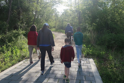
Previously, we hiked the
South Wind Trail of the Middle Patuxent Environmental Area. We went back to try out the Wildlife Loop Trail to see how it compared.
 |
| Sign at the entrance |
 |
| Building at entrance |
 |
| I guess this graffiti is okay? |
This entrance has some bathrooms and a maintenance facility. The path into the park is paved but only for a short way.
 |
| Leaving the paved trail |
An open meadow attracts many butterflies. It has both sunshine and protection from the wind along with some plants good for cocooning caterpillars and others good for nectar-gathering butterflies. Early spring was not a good time for seeing the beauties.
 |
| Butterfly habitat (not sure why they included a birdhouse) |
The next field is good for woodcocks and other birds, giving shelters and food opportunities for them.
 |
| Woodcock info |
 |
| A cool budding tree |
The trail is very well marked and led us further into the forest.
 |
| A can't-miss sign |
The area has a good variety of trees. Previously, the land was used for corn farming. Once the farmers left, Virginia pine trees were planted. The deciduous trees are outgrowing them and squeezing out the light. Competition can be fierce in nature.
 |
| A tree getting overwhelmed by vines (another problem) |
 |
| A spikey tree |
Signpost 4 marks a spot with a deer exclosure. The deer are overpopulated and eating up a lot of the smaller bushes and plants, taking away not only the plant species but the other animal species dependent on the plants. The "gated community" in the forest is part of a long-term research program at the MPEA.
 |
| Barely visible deer exclosure |
Further along is an area with spicebush. The berries are popular with local birds and the bushes are larval host plants for spicebush swallowtail butterflies. The bushes taste bad to deer, so no need for fencing.
 |
| Again, too early for butterflies |
 |
| The marker for spicebush |
The path gets steeper as it heads down to the river. The water from this area drains into the Middle Patuxent River which eventually goes to the Chesapeake Bay.
 |
| Drainage area |
 |
| We go "down the drain" |
A raised walkway kept our feet out of the muck and the strange plants in the flood plain area, yet another habitat for other plants and critters.
 |
| Easy to follow the trail here |
 |
| What are these? |
Near the Middle Patuxent River is the remains of an "oxbow," a curve in the river that is no longer part of the river because the course of the river bed changed. One end of the oxbow might have had a log stuck across it that accumulated other fallen limbs and detritus that dammed the river flow, sending it on another path. This particular oxbow is also spring-fed, so it has water in the late spring and early summer.
 |
| Used to be the river |
 |
| View from the bridge |
 |
| The actual river |
 |
| Why do I find these tree root systems fascinating? |
 |
| More of the river |
 |
| Cool reflective part of the river |
The area cut off by the oxbow had some interesting vegetation, including this tree with lots of vines.
 |
| Tarzan's paradise |
 |
| Bridge over the other end of the oxbow |
The other end of the oxbow only had some big puddles.
 |
| Definitely not a river |
Another invasive species in the area is the multifloral rose taking over the area around post 14.
 |
| It's coming to get you! |
 |
| Some drainage in the area |
Evidence that the area used to be farmland--the remains of a concrete wading pool! It was turned into an amphibian habitat by local students.
 |
| Marker for the habitat |
We saw another example of previous human habitation.
 |
| Um, I don't think you are allowed to park there |
 |
| Along with the frog pool, this might make a good horror movie location? |
Further up the hill is a clearing that is being taken over by invasive species. The interpretive sign nearby shows some local heroes fighting the good fight.
 |
| When does an invasive species become a local species? |
 |
| Eco-Goats to the rescue! |
A nearby field is set up as an outdoor classroom.
 |
| Open space and shady! |
The park is fun to visit but the kids like the other trail better because the river area had a lot of boulders and beaches to explore. If we come back, we will definitely go to the South Wind Trail.


No comments:
Post a Comment