We went for a local hike to the
Middle Patuxent Environmental Area. The website shows two different hikes. The South Wind Trail is slightly shorter (2.3 miles to the Wildlife Loop's 2.4 miles). The entrance is on a neighborhood street with free street parking. We almost took a paved path that is part of the Columbia trail system, not the MPEA hike. My eldest spotted the sign for the park, which has a dirt trail behind it.
 |
| Not my oldest son |
A few small fields are sprinkled throughout the area, making habitats for field and forest animals. They attract a good diversity of flora and fauna. We hiked in early spring, so not much sign of either yet.
 |
| A pleasant field |
 |
| Walking the trail |
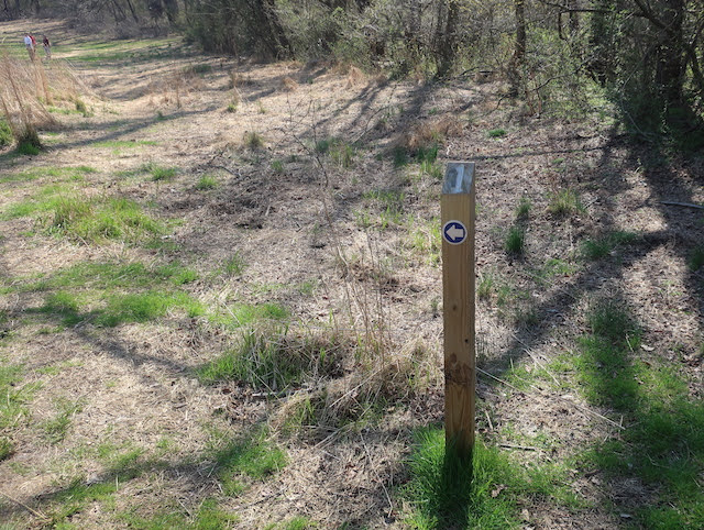
The trail features markers that match the descriptions on the
trail brochure which I downloaded from the website.
 |
| Marker #1 |
 |
| Another field with some additional habitats in the distance |
We came to a fork in the trail and chose a route randomly. The choice didn't matter so much since this is the loop part of the trail, meaning we'd come back out the other tine of the fork.
 |
| Going right |
Part of the area is an easement for utilities, including rain sewer lines, so we saw some unusual forest dwellers.
 |
| At least that hole in the ground is covered! |
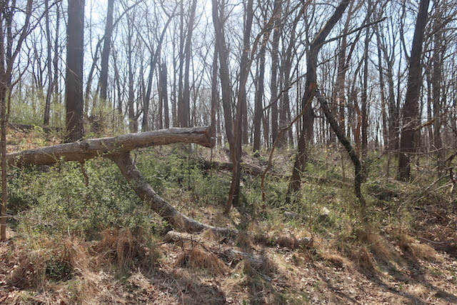
This area has lots of fallen trees that are left where they lie in order to provide shelter and food for the local critters.
 |
| "Y" did it fall down? |
 |
| Another trail marker that blends in well |
 |
| Plenty of undergrowth |
The park has many small and large tributaries that feed into the Middle Patuxent River (there's also a Little Patuxent River and a plain old Patuxent River). Some are little more than runoffs from higher ground.
 |
| A small stream hiding in the undergrowth |
 |
| The tributary and my son cross the path |
 |
| A mighty leap! |
The path turns along Cricket Creek, the largest tributary in the park. The kids wanted to throw stones, climb over rocks, and even cross the creek if they could. I encouraged everything but the last.
 |
| A fabulous find |
 |
| Cricket Creek |
 |
| Out in the water |
 |
| Relaxing rock |
The trail parallels the creek with the occasional bridge for humans over muddy bits of the trail. Just off the bridge we saw tracks for non-humans.
 |
| Looking around |
 |
| Some identifiable prints |
We weren't quite sure where the creek ended and the Middle Patuxent began. So we explored more sections of the flowing water.
 |
| Out on a sandy bank |
 |
| Further out, coming back |
 |
| Beautiful water |
 |
| Not sure if that was a man-made or nature-made dam/crossing |
 |
| A spooky hollow |
We took the opportunity to throw more rocks. A new popular sport was throwing rocks to the other bank of the stream.
 |
| Looking for the perfect stone |
 |
| The beach is on the wrong side (from our perspective) |
 |
| Another attempt at crossing |
I am fairly certain this next view is definitely the Middle Patuxent River.
 |
| Should we throw more rocks? |
The walk back was fun with more of the same foresty goodness.
 |
| More fallen trees for the bugs and the animals to enjoy |
We may go back to this trail. We will definitely try out the other trail soon.


Nice post thanks for sharring
ReplyDelete