Thursday, April 30, 2020

Book Review: ZombieWorld: Champion of the Worms by M. Mignola et al.

ZombieWorld: Champion of the Worms story by Mike Mignola and Art by Pat McEown


A small-time museum is about to open a new exhibit featuring archeological items from Hyperborea (a mythic ancient civilization buried under Arctic ice), including the sarcophagus of Azzul Gotha. Gotha was an ancient Hyperborean necromancer who worshiped evil worm gods. He was entombed alive with a sacred medallion sealing him inside. Well, the medallion has gone missing, as has the mummy of Azzul Gotha. Some Hyperborean experts are called in. They soon discover the other mummies in the museum are coming to life and Gotha has a plan to turn the world over to the worm gods, just like he was planning to do forty-two thousand year ago.

The story shares a lot with Mignola's Hellboy universe. The ancient society of Hyperborea features in both stories, as does a team of paranormal experts. This team is all-human with only one character who has paranormal abilities--he can send out his spirit to spy on Azzul Gotha, much like Johann Krauss in the Hellboy universe. Even with the parallels, I still found the story entertaining and was surprised by the ending. The art is a mixture of Mignola and Herge's Tintin, a weird combination that works.

Dark Horse Comics put out four other stories in the ZombieWorld universe. I'm not sure this volume was strong enough to get me to read the other material, especially since Mignola was not involved in the subsequent stories.

Mildly recommended.


Wednesday, April 29, 2020

Book Review: Scary Stories to Tell in the Dark by Alvin Schwartz

Scary Stories to Tell in the Dark: Three Books to Chill Your Bones compiled by Alvin Schwartz with drawings by Stephen Gammell


This kid-friendly horror anthology features lots and lots of stories (typically one or two pages long) from the eerie to the ridiculous. Some are fairly familiar (the night-time hitchhiking woman who disappears just before the driver gets to her home; someone who takes money to spend a night in a haunted house; others like that). Some are designed to be read out loud, like by candlelight or during a campfire. Some are macabre songs. Some are laugh out loud funny. The author collected these stories from across America and has done a great job putting together light and entertaining materials. The drawings by Stephen Gammell are a bit gruesome but they are in black and white, which takes some of the horror out. Still, the illustrations are a bit more macabre than the stories.

I may use some of these stories next time we go Cub Scout camping.

Recommended.


Tuesday, April 28, 2020

Exploring the Neighborhood During the Pandemic

Thanks to the Coronavirus Pandemic, we have been going for lots of walks in our neighborhood. It sure seems like a nice suburban...suburb. I mean, look at this sidewalk graffiti!

What great neighbors!

But then it happened. We took a walk into the woods and made some discoveries.

The woods...nothing creepy or awful ever happens there, right?

Having just heard a podcast reading of H. P. Lovecraft's The Colour Out of Space, I was less than enthused to find skunk cabbages littering our path. In the story, a stone crashes from the sky and something from beyond our friendly earth gets into the ground. All the vegetation and the animals (including the human animals) start going...wrong. Skunk cabbages in the story grow to unusual sizes and in unusual shapes. In our woods, they have that "innocent look" about them, but the smell is something out of an eldritch nightmare. I know, because my kids made me smell them. In fact, they had walked here before, so maybe they are already under the malign influence of otherworldly horrors.

Is there such a thing as innocent-looking skunk cabbages?

They said they were taking me to "the Black Lagoon," of Creature from... fame, but this body of water was clearly too small to hide a fish man.

More like a Black Puddle

My children were quick to inform me that the true lagoon lies farther into the woods. And they led me on.

Looking down at...

...the lagoon!

We took a long time throwing stones in, which seemed like a bad idea in case he was napping under the water. If the Covid-19 virus has taught me anything, it's that nobody likes their afternoon nap interrupted. Maybe the Creature had gone for a walk.

We walked away, discovering a trickle that feeds into the lagoon. The water looks pretty terrible, especially with a skunk cabbage growing in it.

Water so evil it unties shoes!

Our walk continued to another area with classic Lovecraftian features--the remains of an ancient and abandoned civilization. We saw a small brick ruin and approached carefully.

Hard to distinguish from the woods

Nature covering up for a human (or non-human) mistake?

Nothing to see here

Just up the hill is an abandoned roadway with neglected power lines.

Above the ground power lines, clearly from ages past

The houses were gone. Only concrete foundations with bits of plumbing and electrical connections were left.

The footprint of a home?

The trees taking over for the power lines

Another abandoned concrete pad

A nearby parking lot had only one trash can and one barrier. The emptiness was reclaimed by the vegetation. At least there weren't any skunk cabbages.

Nature abhorred this vacuum

We ventured deeper into the woods.

The bright sunshine ruins the creepiness

We found some more ruins and a last source of water. If only it had been potable water.

More concrete detritus

Maybe this is safer than Black Lagoon water?

We made it home alive and were more enthusiastic than ever about sheltering in place!

Monday, April 27, 2020

Orienteering on the Wincopin Trails

One of my older son's requirement for Scout advancement is to go orienteering on a course. Our area of Maryland has several courses within an hour's drive. Happily, one was very close to home in Wincopin Park, part of the Howard County park system. The trails are used by hikers, birders, dog walkers, and joggers. One scout from Troop 617 set up an orienteering challenge in the park as his Eagle Scout project.

The orienteering map can be found on the Troop's website here. Here's a quick shot of it.

The map of the control points

The map shows the location of twelve point inside the park that can be found using a compass and a little bit of measuring. The orienteer calculates the distance and direction from one point to another and then finds the second point. The map has topographical lines to show changes in elevation. A bunch of lines together show a steep slope, like between the river and the lake.

We started at the start marker on the top of the map.

At the park's entrance

We set out without measuring the distance to the first mark and had to backtrack. After calculating the distance on the map and dividing by the average length of his stride, my son determined how far away the first control point was.

The start marker is number 0

The points are set up close to the paths so that orienteers do not have to go off into the woods, which can be challenging when there is lots of summer overgrowth. We visited on a Sunday morning in mid-April, so the weather and the vegetation were quite cooperative.

Finding the first point

We did more calculating for #2 and #3 and found them fairly easily.

At point #3

Looking down the ridge from point #3

One of the challenges with orienteering is deciding which path to take at a fork. With a knowledge of the direction and topography, we were able to make smart choices.

Figuring out which path to take

At point #5

The path between points #5 and #6 lead us to the ruins of a stone dam. We took a break to explore what was left.

Finding ruins

Wandering inside

More overgrown ruins

The depth of the dam

Near point #6 is the remains of the Gabbro Bridge Support, part of an old and abandoned railroad bridge.

Finding #6

An old bridge support

View from the support

The view upstream from the support

With half the course done, you'd think we'd take a break for water and snacks but we were too excited to stop. We walked up river, having to decide whether to take the low road or the high road.

Which path?

On the other side of the river is a housing development that was just barely visible through the trees.

Houses on the other ridge, if you can see them

We walked along the river till we came to a part of the trail blocked off.
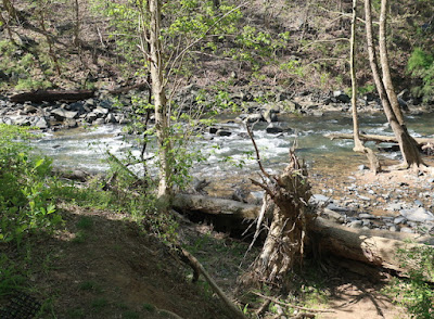
What passes for rushing rapids around here

The blocked path

We went uphill from #7 (not pictured) to find #8.

#8

The path here was much more accommodating.

Rocks curiously stacked

Another choice led us to a scenic overlook.

Which way to go

The overlook spot (though not much to see)

Another trail choice

The final set of points were along the river, a very pleasant walk. Interstate 95 was somewhat close by and we heard the cars going by. The noise was fairly easy to tune out as we enjoyed nature.

Another find

The calm river

Walking back uphill

The final mark, #12, was easy to find at the top of the hill.

Finished!

More curiously stacked rocks

As we walked out, we noticed more and more people walking in. At one point, we almost hit the Covid-19 limit of ten people within six feet of each other, but we managed to keep our distances. I think one group left a rock behind.

A bit of encouragement

We made it out fine after a relaxing and fun two-hour hike. We recommend the trails, even if you don't have to finish a Scouting requirement!

Back at the start