I dragged the kids off for another hike, this time along the north half of the
Grist Mill Trail at
Patapsco Valley State Park. We parked at the Ilchester Road end of the trail, though we had a hard time finding parking. The roadside had some space to park but plenty of "No Parking" signs too. We took a side road long enough to get past the "No Parking" zone. A quick walk down the hill brought us to the first bridge over the Patapsco River.
 |
| Can someone move that sewer access? |
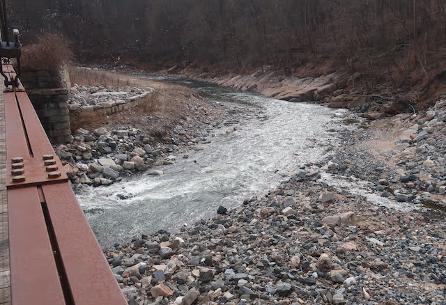
The bridge was fun to cross and gave a view upriver to a train bridge (it's the line that goes into Ellicott City).
 |
| Crossing the river, the dry way |
 |
| A funky-looking drain into the river (maybe three-eyed?) |
 |
| The river coming out from under the bridge |
 |
| Getting the "You shall not pass!" routine |
 |
| The train bridge |
The plan was to walk down to the Swinging Bridge and take the trail on the other side of the river back. As I looked across the river, I was a little nervous about the return trip. I didn't see anyone walking along the trail. I did see what looked like an icy coating.
 |
| Is that snow or ice? |
Bloede's Dam was located along this trail. The dam was the first hydroelectric dam where the power generator was inside the spillway. It's named after Victor Gustav Bloede (pronounced
Blerda), a local chemical manufacturer who paid for the dam. It was built in 1906 and ran until 1924. It deteriorated over the years and was demolished from 2017 to 2019. Trees were planted along the side to help soil retention.
 |
| No dam here |
 |
| A one-eyed drain? |
 |
| Hanging out by the river |
My oldest son tried throwing stones across the river, a tough challenge.
 |
| Standing on a dam pipe |
 |
| A retaining wall |
The trail has a washed-out section. A large drain that serves as bridge for a railroad track must have let a lot of water out back during the Ellicott City floods in 2016 and 2018.
 |
| Not bike-friendly |
 |
| A really big drain |
Naturally, the kids wanted to explore it. Shouting in the interior made great echoes.
 |
| Is it safe in there? |
 |
| Noisy enjoyment |
Not much further, other signs of civilization were visible.
 |
| Where do these stairs go? |
 |
| First view of the Swinging Bridge |
We came to our "turn around" point, the Swinging Bridge. The bridge was made for workers at the Orange Grove Flour Mill, which probably used the electricity from the dam and the rail line up above to ship their goods. The mill and the nearby residences are gone but the bridge, like
The Dude, abides.
 |
| A better view of the bridge |
 |
| Crossing the bridge |
 |
| View from the bridge |
 |
| A more cautious traveler |
More on the hike in the next post!


No comments:
Post a Comment