Showing posts with label ruins. Show all posts

Tuesday, March 4, 2025

Savage Mill Hike 2025

We've been on a bunch of hikes on the trails by Savage Mill (for example, here). The path system follows the Little Patuxent River which provided power for the mill back in the 1800s. The path toward the mill is usually blocked by overgrowth, but we managed to get through in February. The path was a little creepy, especially this uninviting drain pipe. 

This is not a Mario-friendly entrance

The path along the river led us below the back parking lot for the mill. We could see some of the Terrapin Adventures outdoor challenges up the hill.

A sign of slightly safer civilization

Also up the hill, we spotted some deer. Can you find the critter in the photo above? The photo below is a spoiler, sort of...

Great natural camouflage

Ruins of the mill are also visible from the path, though we were not sure what we were looking at. 

Maybe a gate for the mill run?

The river is fairly peaceful here with little signs of human impact.

Houses on the hillside opposite

We found what we thought might be the other end of the pipe from above. We did not investigate too closely.

An exit? An entrance? A wishing well?

We finally made it to the mill ruins on the river, some structures we have never seen close up. They are visible from a trail along the other side of the water and from the Bollman Bridge.

Almost to the end of the trail

A combination of history and teen art

Plenty of machinery is still left inside. Probably it was too heavy to move or not valuable enough to relocate.

Mill equipment

Pipes

We found a steep and treacherous trail up the side of the ruins to the mill. We came up near the kids challenge course for Terrapin. A group of kids were climbing around and the supervisor said hi to us while cautioning us about staying away since we didn't have helmets. I suppose stuff might have dropped on us? We cleared out quickly without photos. As we walked along, we saw some of the hillside ruins from the other side.

The other side of the gate?

We went into the mill to get a snack and do a little shopping. While it was harrowing to climb up the hillside to the mill, it was a lot faster than backtracking all the way to the parking lot. The hike was fun but we probably won't do it again, definitely not with mom!

Tuesday, December 24, 2024

Snead Farm Trail, Skyline Drive, Virginia

We hiked the Snead Farm Trail off of Skyline Drive in Virginia. The trail is right off the Dickeys Ridge Visitor Center area with the farm being on the eastern side of the ridge. At first, the trail was paved, quite the luxury. It did not last long, though.

Trail head fit for a king

The trail turns to gravel

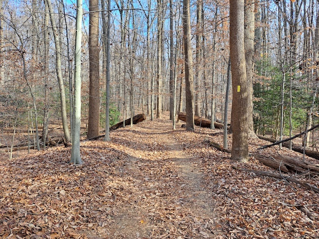
We leave the gravel trail to head to the farm

A rocky road, but also power lines!

We were sure we were going the right way even though the conditions kept getting lesser and lesser. At least the trail is marked with signs for the right path.

Which way to go

All the frills are gone

The original settlers for the farm were Thomas and Martha Fox, who came to the area in 1856. The last Foxes left in 1935 and the farm was abandoned in the 1950s when Skyline Drive was being completed. The main structure that still stands is a barn. It hasn't grown any moss or shown many cracks. It's hard to see inside, so we just wandered around the outside.

View from the "road"

In good shape for its age

Behind the barn is a small structure that looks like a root cellar or other storage building dug into the hillside.

Actually creepy, unlike the barn

Nearby are the foundations of the farm house. Only the stone work and a pipe are left. The front must have been a yard, judging by how big the trees are...and the stone staircase is set some ten feet back from the retaining wall (or foundation if the house really went that far).

Bottom part of the house

Near the house but unidentifiable

Stairs too short to be interior ones that lead to a second floor

A bit of plumbing

Big tree inside the retaining wall/foundation

My family not posing for a picture

Cracked foundation

Climbing down the wall

Trail leading away from the farm

The trail continued on in a loop around Dickey Ridge. It had the usual assortment of sights.

Rocks lining the way

Scat we couldn't identify

Deer in the woods

More of the same deer

Stopping for a snack

Little rocks and big rocks

At one point, the trees did not block the view out over the Shenandoah Valley, which looked fairly spectacular.

Shenandoah

More of the valley

Sunshine in the distance

Looking from higher up

Me and the missus

Kids waiting to continue on

We were delighted that snow fell a few times while we were up there. It didn't accumulate and the air wasn't too cold for comfort. It was a longer hike with some more challenging terrain, but we had a good time. 

We went back to the visitor center to warm up a bit and see some exhibits. We avoided the gift shop.

Map of Skyline Drive

View from the visitor center

Bear-proof trashcans

Tuesday, December 3, 2024

Gold Mine Trail, Great Falls, Maryland

We made another visit to Great Falls, Maryland, which has a national park that is part of the C&O Canal. The area has lots of trails. One leads to Maryland's gold mine! We wanted to check it out, so we started on the spur that led to the gold mine loop.

Connecting the canal path to the gold mine path

The kids were more or less excited to be there... 

Enthusiasm!

The trail winds through the woods between the Potomac River and Macarthur Boulevard. Some of the downed trees are quite picturesque.

Trees are not allowed to cross the path!

One with a lot of branches

After a while we made it to the site of the gold mine. Back in 1861, a Union soldier was stationed on the Maryland side of the Potomac and noticed the glint of gold in a stream as he was cleaning up. He came back after the war, bought some farmland, and started mining for gold. Over 30 mines sprang up in the area but not much came out of the ground. What's left of the building where they refined the ore into gold still stands, though it is fenced off to protect unintelligent visitors.

Information sign

Ore processing building

A future water tower

We stopped for a snack before continuing around the loop. The plan was to take another spur to the canal so we wouldn't have to repeat our path.

Having a snack

Low tree

Successfully hiding behind mom

An odd collapse

The trail got steeper as we headed down to the water.

Virginia in the distance

Not fast enough to escape the picture

Our exit

Looking back uphill

We saw another ruins that we thought must be the house of a lock-keeper. The canal has a lot of locks in this area to avoid the falls and rapids on the Potomac. 

Waterfront property!

The canal and the river

The road led to a dead end with a geocache that I found while everyone else got a head start to the car.

Ground zero for the geocache

The canal has a covered pedestrian bridge over it that let us go over to the main tow path.

Why make the bridge like this?

View up river/canal

View down river/canal

We spotted a blue heron by the canal. It was far enough away that we couldn't disturb it even with taking a picture.

Chilling on the canal's shore

The park has still other trails, so another post may come sooner or later.