One of my older son's requirement for Scout advancement is to go
orienteering on a course. Our area of Maryland has several courses within an hour's drive. Happily, one was very close to home in
Wincopin Park, part of the Howard County park system. The trails are used by hikers, birders, dog walkers, and joggers. One scout from
Troop 617 set up an orienteering challenge in the park as his
Eagle Scout project.
The orienteering map can be found on the Troop's website
here. Here's a quick shot of it.
 |
| The map of the control points |
The map shows the location of twelve point inside the park that can be found using a compass and a little bit of measuring. The orienteer calculates the distance and direction from one point to another and then finds the second point. The map has topographical lines to show changes in elevation. A bunch of lines together show a steep slope, like between the river and the lake.
We started at the start marker on the top of the map.
 |
| At the park's entrance |
We set out without measuring the distance to the first mark and had to backtrack. After calculating the distance on the map and dividing by the average length of his stride, my son determined how far away the first control point was.
 |
| The start marker is number 0 |
The points are set up close to the paths so that orienteers do not have to go off into the woods, which can be challenging when there is lots of summer overgrowth. We visited on a Sunday morning in mid-April, so the weather and the vegetation were quite cooperative.
 |
| Finding the first point |
We did more calculating for #2 and #3 and found them fairly easily.
 |
| At point #3 |
 |
| Looking down the ridge from point #3 |
One of the challenges with orienteering is deciding which path to take at a fork. With a knowledge of the direction and topography, we were able to make smart choices.
 |
| Figuring out which path to take |
 |
| At point #5 |
The path between points #5 and #6 lead us to the ruins of a stone dam. We took a break to explore what was left.
 |
| Finding ruins |
 |
| Wandering inside |
 |
| More overgrown ruins |
 |
| The depth of the dam |
Near point #6 is the remains of the Gabbro Bridge Support, part of an old and abandoned railroad bridge.
 |
| Finding #6 |
 |
| An old bridge support |
 |
| View from the support |
 |
| The view upstream from the support |
With half the course done, you'd think we'd take a break for water and snacks but we were too excited to stop. We walked up river, having to decide whether to take the low road or the high road.
 |
| Which path? |
On the other side of the river is a housing development that was just barely visible through the trees.
 |
| Houses on the other ridge, if you can see them |
We walked along the river till we came to a part of the trail blocked off.
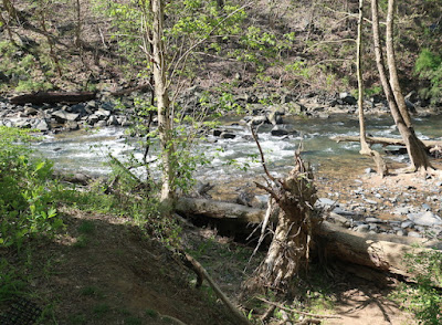 |
| What passes for rushing rapids around here |
 |
| The blocked path |
We went uphill from #7 (not pictured) to find #8.
 |
| #8 |
The path here was much more accommodating.
 |
| Rocks curiously stacked |
Another choice led us to a scenic overlook.
 |
| Which way to go |
 |
| The overlook spot (though not much to see) |
 |
| Another trail choice |
The final set of points were along the river, a very pleasant walk. Interstate 95 was somewhat close by and we heard the cars going by. The noise was fairly easy to tune out as we enjoyed nature.
 |
| Another find |
 |
| The calm river |
 |
| Walking back uphill |
The final mark, #12, was easy to find at the top of the hill.
 |
| Finished! |
 |
| More curiously stacked rocks |
As we walked out, we noticed more and more people walking in. At one point, we almost hit the Covid-19 limit of ten people within six feet of each other, but we managed to keep our distances. I think one group left a rock behind.
 |
| A bit of encouragement |
We made it out fine after a relaxing and fun two-hour hike. We recommend the trails, even if you don't have to finish a Scouting requirement!
 |
| Back at the start |


No comments:
Post a Comment